I’ve always wanted to solo hike the Australian Alps Walking Track, one of the country’s longest and remote hiking trails in the high country. During my summer season at Mawson station I had one of my hiking guide books with me, which meant during my personal time I could pour over track notes, examine the topo maps, and generally plan what would be the longest bushwalk I’ve done so far.
The entire official route AAWT is 655km long and a very strenuous hike, particularly with the very steep sections over the Victorian section. Most people take six to ten weeks to complete the hike from end-to-end. Considering the longest hike I’d done to date were three-dayers, or base-camping with short trips, I wanted to pick a hike which was challenging but achieveable.
I went with a north-south route starting at Tharwa ACT and ending in Thredbo NSW, taking about two weeks. From a logistics perspective I figured it would work as the week before I could organise a food drop in Kiandra, then for the hike I could get the Xplorer train from Sydney, a mate in Canberra offered to drop me off at Tharwa, I’d walk the trail, stay in a comfy hotel at the end, then organise public transport back to Sydney.
Speaking with fellow hikers on the trail I’d also discover that many people enjoy the Kiandra to Tharwa trail via Blue Waterholes, taking about 8 days, and to a lesser extent Thredbo to Kiandra via the Main Range, taking somewhere around 6-8 days, depending on route, side-trips, and weather.
Day 0: Sydney to Tharwa
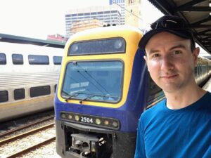
This afternoon I left Sydney Central on the Xplorer train. It’s a pleasant trip down to Canberra. When I arrived at the station, a mate picked me up and we grabbed a bite to eat. Luke dropped me off at Tharwa and kindly helped me setup my tent for the evening.
It felt a bit odd staying at a commercial campsite in Cuppacumbalong – I’d be spending the next two weeks on the trail through National Parks for free. However at the low price of $20 it meant I had a hot shower and facilities on the last night before leaving civilisation, and there was a power point at the side of the homestead I used to charge up my devices. The owners were also super lovely and offered to drop be at the visitor centre in the morning which is very kind, but I was leaving at sunrise so politely declined the nice offer.
I was all settled in for my big adventure.
Day 1: Tharwa to Honeysuckle Campground
Distance 20.8km. Ascent 1233m. Descent 723. Max elevation 1174m.
Leaving Cuppacumbalong Homestead campground I made an early start walking down Naas Road to the Namadgi Visitor Centre. It doesn’t open till 9am daily, but it was still good to pop by and fill up the water containers.
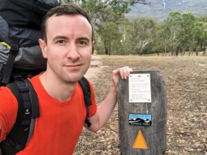
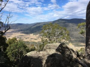
And so began my two week adventure. With a heavy pack full of supplies I commenced the trail up Mt Tennant. It was amazing on the way up to look north and see Telstra Tower and other features of the Canberra skyline.
Day 2: Honeysuckle to Sawpit Creek
Day 2
Day 3: Sawpit Creek to Oldfields Hut
Day 3
Day 4: Oldfields Hut to Blue Waterholes
Day 4
Day 5: Explore Blue Waterholes
Today was a rest day.
Day 6: Blue Waterholes to Hainsworth Hut
Day 7: Hainsworth Hut to Witzes Hut
Day 8: Witzes Hut to Four Mile Hut (via Kiandra)
Day 9: Four Mile Hut to Happys Hut
Day 10: Happys Hut to Mackays Hut
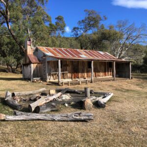
Day 11: Mackays Hut to Mawsons Hut
Day 12: Mawsons Hut to The Rolling Ground
Day 13: The Rolling Ground to Horse Camp Hut
Day 14: Horse Camp Hut to Thredbo
Day 15: Thredbo to Crackenback
Not really part of the Tharwa to Thredbo hike, but I had to get home somehow! After a pleasant night at a hotel in Thredbo, I hiked out of the park to Crackenback, and booked a taxi back into Jindabyne for a final overnight then train back to Sydney.